TorWIC-Mapping
Notes on the Dataset
- The different epochs have no chronological order, but are grouped according to the type of changes.
- Different epochs can be stitched together to create different, changing environments.
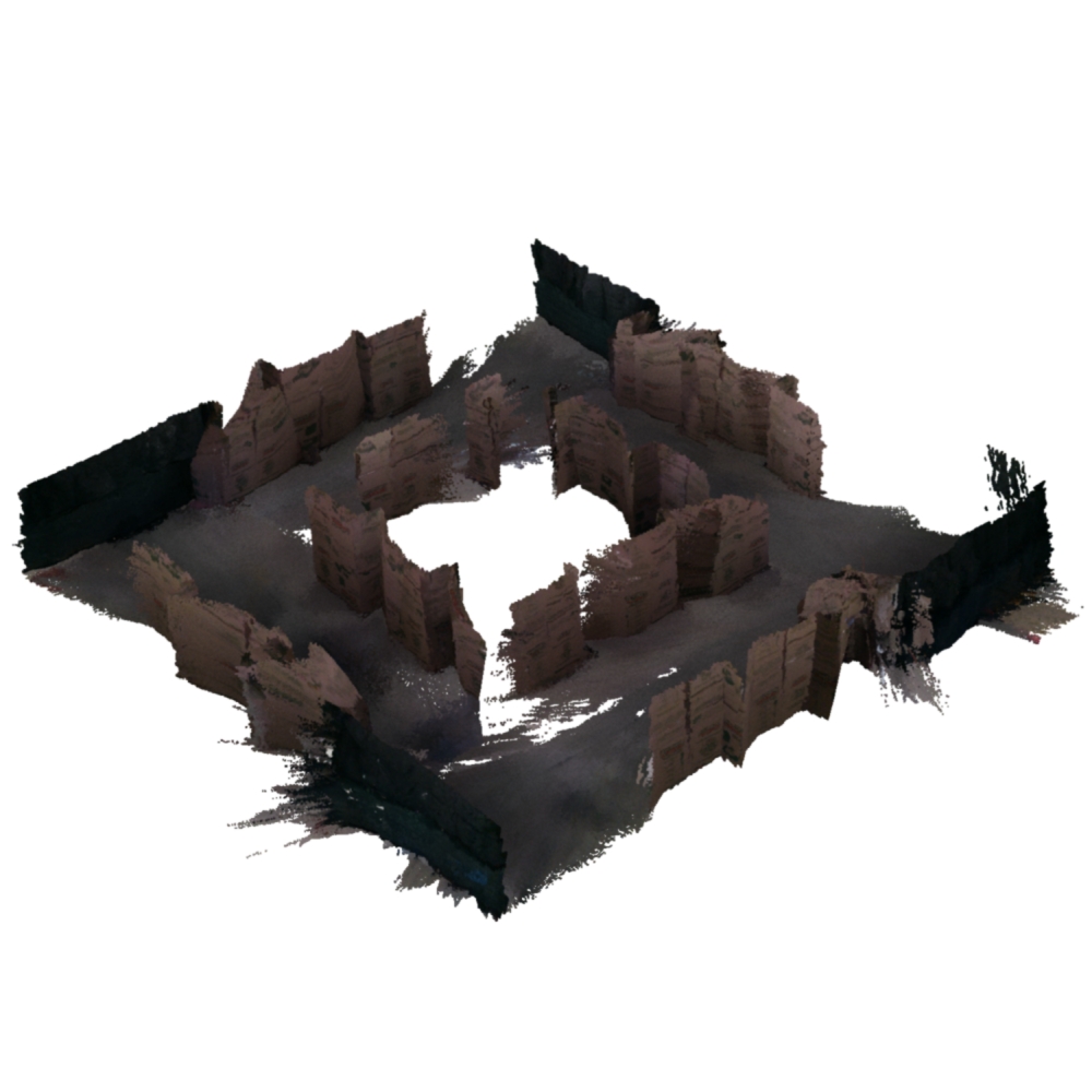
- The changes are not annotated in the point cloud, but exist in the form of maps per epoch.
- The semantic labels are predicted from the RGB frame and are, therefore, not perfect.
- The "Calibration" folder, which should contain the camera intrinsics, is empty. However, in `utils/calibration.py` of the accompanying source code, the intrinsics appear to be hardcoded.
- The depth images are quite noisy for farther away surfaces. When thresholding the depth values, the point cloud reconstructions are of significant better quality.
- For the segmentation images of Scenario_1-1, the file names have six digits instead of four (as is the case for all other epochs).
Detailed Information
| General Information | |
| Name | TorWIC-Mapping |
| Release Year | 2022 |
| Terms of Use | Unclear (Citation) |
| Access Requirements | None |
| Dataset Size | 69.7 GB | Partial download is possible, i.e. the data is split into several files (e.g., epochs or data types) |
| Documentation | In-depth documentation of acquisition and characteristics of the dataset, e.g., via an explicit dataset paper or a comprehensive multi-page metadata document |
| Code | Yes |
| Applications | Long-term localization and mapping | Built environment change detection and classification |
| Detailed Applications | Long-term mapping | object-level change detection |
| Acquisition | |
| Number of Scenes | 1 |
| Number of Epochs per Scene (minimum) | 18 |
| Number of Epochs per Scene (median) | 18 |
| Number of Epochs per Scene (maximum) | 18 |
| General Scene Type | Indoor |
| Specific Scene Type | Boxes and fences |
| Location | Toronto (Canada) |
| Acquisition Type | Depth camera mounted on vehicle |
| Acquisition Device | RealSense D435i RGB-D camera |
| Acquisition Platform | OTTO 100 robot |
| Scan Interval | Minutes | Educated guess by the authors |
| Acquisition Months | Janurary: 0 February: 18 March: 0 April: 0 May: 0 June: 0 July: 0 August: 0 September: 0 October: 0 November: 0 December: 0 |
| Representation | |
| Data Representation | Structured, local (e.g., RGBD or range images with poses (and intrinsics) |
| Specific Data Representation | Color and depth images |
| File Format/Encoding | PNG |
| Raw Data | ROS bags |
| Additional Data | 2D LiDAR |
| Coordinate System | m |
| Quality and Usability | |
| Registration | Coarsely registered |
| Number of Partial Epochs | - |
| Unusable Data Reason | - |
| Splits | No |
| Per-Point Attributes | |
| Intensity/Reflectivity | No |
| Color | Yes |
| Semantic Labels | 16 |
| Instance Labels | No |
| Change Labels | - |
| Statistics | |
| Number of Points per Epoch (minimum) | 135M |
| Number of Points per Epoch (median) | 314M |
| Number of Points per Epoch (maximum) | 488M |
| Avg. Point Spacing (minimum) | 976µm |
| Avg. Point Spacing (median) | 1.3mm |
| Avg. Point Spacing (maximum) | 1.7mm |
| Avg. Change Points per Epoch | - |
Paper Reference 1
@inproceedings{qian2022datasettorwicmapping,
    author = {Jingxing Qian and Veronica Chatrath and Jun Yang and James Servos and Angela P. Schoellig and Steven L. Waslander},
    title = {POCD: Probabilistic Object-Level Change Detection
and Volumetric Mapping in Semi-Static Scenes},
    booktitle = {Proc. Robotics: Science and Systems XVIII},
    year = {2022},
    doi = {10.15607/RSS.2022.XVIII.013},
}