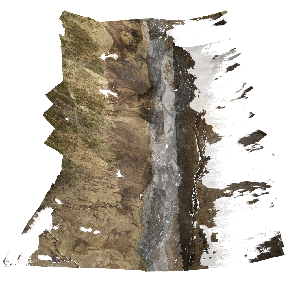
Rotmoos
Notes on the Dataset
- For 2017, only images and ground control points are available, but no reconstructed point cloud.
- The 201906_Rotmoos_TPHG is not georeferenced and seems to depict another location than the remaining scans.
- 20190618_rotmoos_rockfall_THPG depicts another location compared to the other scans (but also in the Rotmoos valley).
- The spatial coverage of the epochs is quite different, which makes it hard to determine the share of partial epochs. If we take the first 2022 scans as reference, 3 of 5 remaining scans have only partial coverage.
Detailed Information
| General Information | |
| Name | Rotmoos |
| Release Year | 2019 |
| Terms of Use | CC BY 4.0 |
| Access Requirements | None |
| Dataset Size | 15.14 GB | Partial download is possible, i.e. the data is split into several files (e.g., epochs or data types) |
| Documentation | In-depth documentation of acquisition and characteristics of the dataset, e.g., via an explicit dataset paper or a comprehensive multi-page metadata document |
| Code | No |
| Applications | Analysis of geomorphological processes |
| Detailed Applications | River morphology monitoring | comparison of point clouds of different modalities |
| Acquisition | |
| Number of Scenes | 1 |
| Number of Epochs per Scene (minimum) | 6 |
| Number of Epochs per Scene (median) | 6 |
| Number of Epochs per Scene (maximum) | 6 |
| General Scene Type | Landscape |
| Specific Scene Type | River valley |
| Location | Rotmoos Valley (Austria) |
| Acquisition Type | Terrestrial laser scanning | Airborne laser scanning | Photogrammetric from aerial images | Photogrammetric from gound-level images |
| Acquisition Device | Canon EOS 6D camera + Agisoft Metashape | RIEGL VUX-1LR | and RIEGL VZ-2000 |
| Acquisition Platform | Handheld | RIEGL RiCOPTER | unspecified UAV | and tripod |
| Scan Interval | Years |
| Acquisition Months | Janurary: 3 February: 0 March: 0 April: 0 May: 0 June: 1 July: 2 August: 0 September: 0 October: 0 November: 0 December: 0 |
| Representation | |
| Data Representation | Unstructured, globally aligned (e.g., point cloud or ray cloud) |
| Specific Data Representation | Point cloud |
| File Format/Encoding | Textfile, usually delimiter separated values | LAS | LAZ |
| Raw Data | RGB |
| Additional Data | Ground control points |
| Coordinate System | 32632 |
| Quality and Usability | |
| Registration | Between finely and coarsely registered. The reviewers disagreed on this |
| Number of Partial Epochs | 60.00% |
| Unusable Data Reason | Not multi-temporal | Other (e.g., no poses for alignment available or in proprietary format) |
| Splits | No |
| Per-Point Attributes | |
| Intensity/Reflectivity | Yes | Only some of the scans have an intensity attribute |
| Color | Yes | Only some of the scans are colored |
| Semantic Labels | - |
| Instance Labels | No |
| Change Labels | - |
| Statistics | |
| Number of Points per Epoch (minimum) | 8M |
| Number of Points per Epoch (median) | 66M |
| Number of Points per Epoch (maximum) | 90M |
| Avg. Point Spacing (minimum) | 3.7cm |
| Avg. Point Spacing (median) | 6.3cm |
| Avg. Point Spacing (maximum) | 2.6dm |
| Avg. Change Points per Epoch | - |
Paper Reference 1
@article{backes2020rivermorphologymonitoring,
    author = {Backes, D. and Smigaj, M. and Schimka, M. and Zahs, V. and Grzn\'arov\'a, A. and Scaioni, M.},
    title = {RIVER MORPHOLOGY MONITORING OF A SMALL-SCALE ALPINE RIVERBED USING DRONE PHOTOGRAMMETRY AND LIDAR},
    journal = {The International Archives of the Photogrammetry, Remote Sensing and Spatial Information Sciences},
    volume = {XLIII-B2-2020},
    year = {2020},
    pages = {1017--1024},
    doi = {10.5194/isprs-archives-XLIII-B2-2020-1017-2020},
}
Dataset Reference 1
@misc{pfeiffer2019datasetrotmoos,
    author = {Jan Pfeiffer and Marco Scaioni and Martin Rutzinger and Marc Adams and Armin Graf and Bernadette Sotier and Bernhard H\"ofle and Roderik Lindenbergh and Sander Oude Elberink and Francesco Pirotti and Magnus Bremer and Thomas Zieher and Martin H\"ammerle and Daniel Wujanz},
    title = {Terrestrial and unmanned aerial vehicle images and point clouds of the Rotmoos valley near Obergurgl, Austria with coordinates of corresponding ground control points acquired during the Innsbruck Summer School of Alpine Research},
    year = {2019},
    doi = {10.1594/PANGAEA.898939},
    organization = {Institute of Geography, University of Innsbruck},
    type = {dataset},
    publisher = {PANGAEA},
}